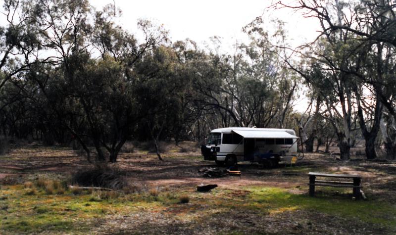
Lake Meran Campground
Last Updated Dec 2014 | Originally suggested by Peter
![]()
![]()
![]()

Leaghuar State Park
A small flat site shaded by open Black Box forest on the southern shore of Lake Meran.
Well off main roads. Could be quite pretty if the lake was full. River Red Gums ring the lake edge.
There is 1 table and 1 fireplace with two isolated bush camps to the east.
Rated 3.7/5
Caravans and big rigs could access the site but take care of overhanging branches.
Kangaroos and rabbits are common.
Together with other lakes in the Kerang area, the combination of warm (shallow) water, reeds and lignum bushes plus an ample supply of insects promotes the concentration of a wide range of water birds.
Although situated in a semi-arid area, the Park is on the Loddon River flood plain which encourages wetland vegetation and habitats, but Black Box forest is rather gray and depressing.
Can be hot in summer, flooded in winter.
Facilities and activities at Lake Meran
- Number of sites:
-
0
- Camping Fees:
-
Free Camping
- Bookings:
-
This is a free camping area.
- How to book:
-
First in, best dressed
- Toilets:
-
No toilets available at this campsite
- Pets:
-
Not allowed
- Water Availability:
-
No water available at this campsite
- Camp fires:
-
No fires are permitted at this camp ground.
- Barbeques:
-
Wood barbeques are available. Bring firewood and check firebans.
- Swimming:
-
There are no known swimming spots at this campsite.
- Fishing:
-
It is not known if there are any fishing spots near this campsite.
- Picnic Tables:
-
Yes.
- Horse Riding:
-
No
- Canoeing / Kayaking:
-
There are canoeing and kayaking spots at or near this campsite
- More Information
Location information for Lake Meran
This site is accessable by caravans in good weather.
From Kerang: West 1k on the Murray Valley Hwy [B400], continue west 0.7k on the Quambatook Rd [C262], left (south) 26k on the Bort Rd [C266], left (east) 300m into the Park (gravel) (signposted). Then generally north for 8-9k on any of the sandy tracks (which are signposted except near the camp).
comments powered by Disqus
Home | Articles | FAQs | Terms | Privacy
© Net Reach Media Pty Ltd 2017
Visit our other sites
CairnsToCape.com.au
What to do, see, where to stay and the wildlife of this spectacular section of Far North Queensland
BushandBoat.com.au
Adventure tours in Port Douglas, Cape Tribulation and the Daintree Rainforest


